MIT Urban Risk Lab Presents Housing Recovery Toolkit at Pre-Disaster Housing Planning Initiative

November 8, 2023

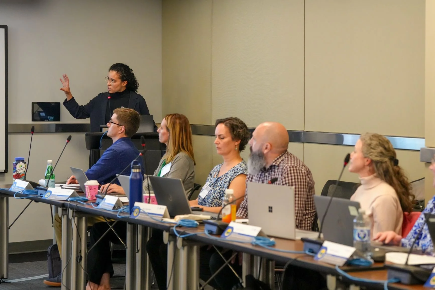
Larisa Ovalles Paulino, a researcher at MIT Urban Risk Lab, delivered a presentation titled "Innovation and Best Practices in Recovery Housing" on November 8, 2023, at the Pre-Disaster Housing Planning Initiative event held in Chicago. Hosted by the Federal Emergency Management Agency (FEMA) and the U.S. Department of Housing and Urban Development (HUD), the presentation delved into the development of the Housing Recovery Toolkit.

The Toolkit serves as a resource for local governments, aiding in the creation of a comprehensive disaster housing pre-planning process that aligns with broader housing and economic objectives. Drawing on insights from interviews with state housing experts and firsthand experiences of communities and survivors, the Toolkit emphasizes the importance of integrating disaster housing considerations throughout the planning continuum.

Ovalles Paulino's presentation included discussions of building resilient housing stock, streamlining planning processes, and operationalizing local preparedness efforts. The initiative, informed by collaborations with five pilot cities, aims to enhance capacity and preparedness at the local level by offering accessible and standardized resources through an online platform.

This presentation contributed to the larger mission of the Pre-Disaster Housing Planning Initiative, which seeks to bolster collaboration between state emergency managers and housing representatives, emphasizing proactive pre-disaster planning and knowledge sharing to better prepare communities for future disasters.

MIT Urban Risk Lab's work presented at APA World Town Planning Day

November 16, 2022

The American Planning Association celebrated World Town Planning Day on November 8, 2022, with the theme of "Think Global, Plan Local". Mayank Ojha, a member of the Urban Risk Lab, was a panelist at the event, where he presented on "Embedding resiliency in the design and management of cities". Ojha's presentation highlighted the importance of incorporating resiliency into urban planning and management in order to create smart, sustainable, and resilient communities and cities. He discussed the Urban Risk Lab's work in developing tools and frameworks to support decision-making in urban planning and management, with the aim of creating more resilient cities while emphasizing the need to take a holistic approach to urban planning, considering the social, economic, and environmental factors that affect a city's ability to withstand and recover from shocks.

New book chapter outlines lessons from RiskMap India for civic sensing during climate disasters

November 15, 2022

With the increased risk and uncertainty brought about by climate-induced floods and cascading disasters, it is essential to empower bottom-up informational networks and community actors as equal partners in scenario planning for future flood events. The bi-directional communication and real-time collaboration tools, such as RiskMap, can help facilitate a wide range of response activities such as community-led evacuation, emergency shelter registration, resource and supply sharing, and navigation for residents.

Based on RiskMap’s pilot in the city of Chennai, India, this invited book chapter outlines the lessons for the role collective civic voluntarism can play during flood events.

Barve, Aditya, Miho Mazereeuw, and Mayank Ojha. "Situational awareness for all: from sensing to collaboration using real-time communication in cities affected by climate change." Handbook on Climate Change and Disasters. Edward Elgar Publishing, 2022. 663-675.

MIT Urban Risk Lab's work presented at Universidad CEU San Pablo, Spain

October 18, 2022

On October 18th, 2022, the Escuela Politécnica Superior at Universidad CEU San Pablo in Spain hosted a lecture by Larisa Ovalles on the topic of “Reducing Risk through Design.” Ovalles presented several design projects from the MIT Urban Risk Lab, which focus on reducing risk and increasing resilience in the urban environment across scales - from individual action to community and regional strategies.The lecture was part of a design studio at the Escuela Politécnica Superior, titled “Ecologies of Intimacy: Borders. In Between Devastation and Life: The dynamics of the burnt forest and their communities.” The studio, led by Professors María Auxiliadora Gálvez Pérez and Valerio Oriol Canals Revilla, focuses on exploring the connections between architecture, ecology, and community.

MIT Urban Risk Lab at Dynamic Data Driven Applications Systems workshop at MIT

October 6, 2022

Mayank Ojha, research associate at the MIT Urban Risk Lab, presented at the Dynamic Data Driven Applications Systems workshop at MIT on October 6, 2022, during the session on "Climate, Life, Earth and Planet Systems". The topic of the presentation was "Localizing Climate Impacts for Sustainable Strategies". Ojha discussed the increasing frequency and intensity of extreme weather events, their disproportionate impact on vulnerable communities and the challenges they face in understanding and planning for future risks. He highlighted the need for more high-resolution data and better communication of information from climate science projections to enable these communities to participate in planning for near and long-term action. As part of the MIT Climate Grand Challenge, the Urban Risk Lab is working with communities to map local "consequence thresholds" and use this information to inform climate science projections and support collective planning and decision-making.

Urban Risk Lab's proposal receives inaugural MCSC Seed Award

June 1, 2022

The MIT Climate and Sustainability Consortium (MCSC) is a cross-institute effort to accelerate research and implementation of large-scale, cross-sector, real-world solutions addressing global climate and sustainability (C&S) challenges. In its first-ever 2022 MCSC Seed Awards program, MCSC selected 20 projects from all five of MIT’s schools.

In collaboration with Prof. Nicholas de Monchaux, this project aims to develop new ways to assimilate bottom-up knowledge in otherwise top-down climate preparedness and response efforts. Through collaborative, community-level data collection, coordination, and planning this toolkit will help foster a culture of consensual, inclusive policy-making around difficult choices such as relocation in the face of exacerbating climate-change impacts.

"Preparing for a New World of Weather and Climate Extremes" is selected as a flagship project for MIT climate grand challenge

April 15, 2022

MIT Climate Grand Challenge is an initiative to deliver high-impact climate solutions. In the first round, 27 teams as finalists from a field of nearly 100 initial proposals. “Preparing for a New World of Weather and Climate Extremes,” a project led by Professor Paul O’Gorman, Associate Professor Miho Mazereeuw, and Professor Kerry Emanuel, was among the five of the most promising proposals that are selected as multi-year flagship projects.

Climate change intensifies extreme weather and climate events, such as the unprecedented heatwave in western North America in 2021 and rainfall from Hurricane Harvey in 2017. These devastating events are becoming more intense globally. Still, we do not adequately know the changing risks for specific regions and communities or how changing extremes will affect the broader use of wind, solar, and hydroelectric energy that is needed to limit future greenhouse gas emissions. This research will address these critical knowledge gaps by improving the science and prediction of extremes and their effects on our energy systems. Based on the improved projections of extremes, This research will build a scalable toolkit, initially focused on cities in the United States and Africa, for communities and stakeholders to prepare and adapt. Our team brings together experts in climate science, engineering, design, and machine learning at MIT with external partners to provide the most significant benefit to communities, municipalities, and industry.

REACT AI: Partnering with Japanese Cities to automate real-time disaster triage.

March 1, 2022

Timely and detailed information is critical during a disaster. With mainstreaming of social-media-based civic voluntarism during disasters, disaster managers often find themselves in a situation where they get overwhelmed by information streaming in through various channels. Real-time Emergency Assessment, Coordination, & Triage (REACT) AI is a research project aimed to automate the triage of this incoming image and text information and help disaster managers focus on areas that need the most attention. By working directly with Emergency Operations Centers in Japanese cities, this project closely integrates non-government and community-led organizations in disaster response, strengthening long-term resilience planning.  

We are also conducting workshops with domain experts and disaster responders to understand the human factors affecting AI outputs and improve labeling criteria for training datasets. These workshops aimed to create tasks and labels consistent with the city’s protocol, are more objective for labelers, and are structured to help make operational decisions based on REACT output. In addition to piloting this model in real-life disaster drills, resulting datasets and underlying methodology will be open-sourced, helping drive the real-world impact of this project.

The project is supported by Google.org and undertaken in partnership with the University of Tsukuba, and Mercy Corps.

Porosity Map: Using MIT campus as a living lab for climate-change resilience through citizen science

October 3, 2021

The MIT campus sits on reclaimed land, originally tidal flats. Since reclamation, both the city and the campus have grown at a rapid pace during the past 100 years. With sea-level rise, increased precipitation, and the associated risk of increasing storm surges it is vital to assess the flood vulnerability of the MIT campus. 

Through this project, we developed a chatbot-based tool that can be used on any mobile phone. This tool will allow for data collection for the whole campus through a group effort with students. This exercise will involve MIT students in an important experiment that also increases their awareness of flood issues and their own stewardship on campus.  Working over three days, members of the Porosity hunt catalogued openings in dozens of buildings across campus to better support flood mapping and resiliency planning at MIT

Read more at MIT News