October 3, 2021
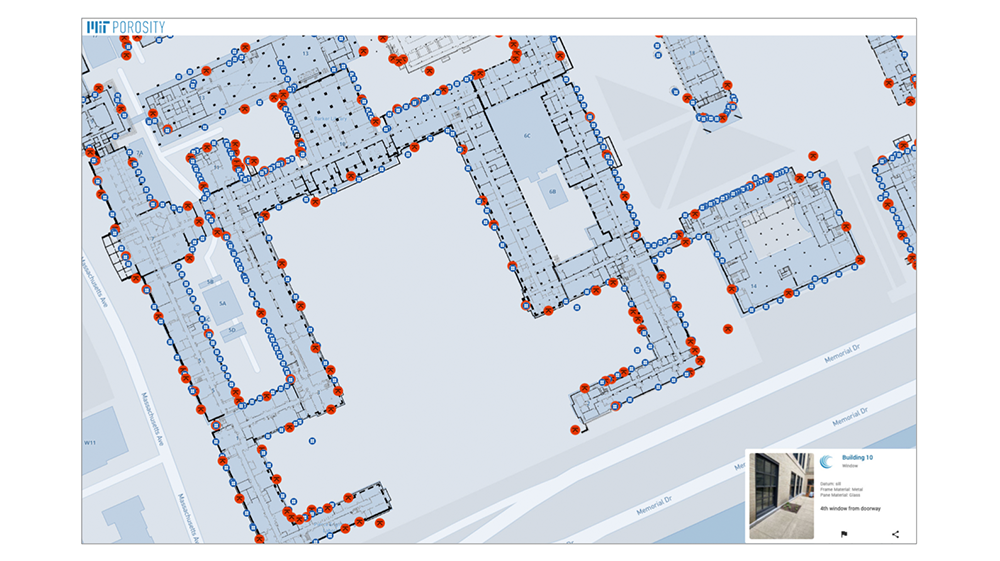
The MIT campus sits on reclaimed land, originally tidal flats. Since reclamation, both the city and the campus have grown at a rapid pace during the past 100 years. With sea-level rise, increased precipitation, and the associated risk of increasing storm surges it is vital to assess the flood vulnerability of the MIT campus.
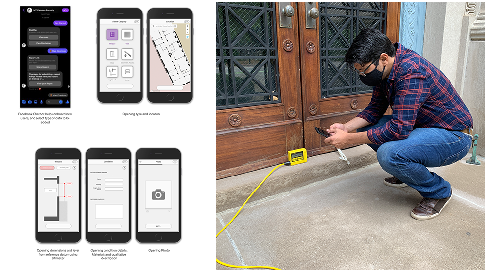
Through this project, we developed a chatbot-based tool that can be used on any mobile phone. This tool will allow for data collection for the whole campus through a group effort with students. This exercise will involve MIT students in an important experiment that also increases their awareness of flood issues and their own stewardship on campus. Working over three days, members of the Porosity hunt catalogued openings in dozens of buildings across campus to better support flood mapping and resiliency planning at MIT