PREPhub-Nepal : Completed Paati handed over to Thecho women's cooperative

November, 2018


Urban Risk Lab - in partnership with Lumanti support group for Shelter, Nepal - completed the pilot project - PREPhub Nepal - A a community-driven design innovation of the traditional building type known as Paati. In the Kathmandu Valley, paati - small, public pavilion - represents a living example of collective management of public infrastructure with centuries-old cultural legacy. In addition to improving their role as a day to day public anchors, this project aims to create a place for people to gather after a disaster, supporting communities in these extreme events. This pilot project in the village of Thecho tackles everyday water scarcity, through storage, treatment, and community-led distribution as well as acts as an emergency back up in the times of disaster with access to water, power and emergency supplies.

PrepHub Nepal has won MIT IDEAS Global Challenge 2016, Lafarge-Holcim Foundation Acknowledgment Prize 2017 and was a finalist for UN RISK Award, 2017.

PrepHub Nepal project is supported by MIT TATA center for Technology and Design , Lafarge-Holcim Foundation and locally implemented by Lumanti Support Group for Shelter.

Accelerating Innovation: DesignX at MITArchA

October 23rd, 2018


Larisa Ovalles, Research Associate, presenting PrepHubs at the MITArchA event

Larisa Ovalles, Research Associate, presenting PrepHubs at the MITArchA event

Gilad Rosenzweig MCP ’13, Executive Director of DesignX, Larisa Ovalles SM 16’ Research Associate at the Urban Risk Lab, Stephanie Lee M.Arch ’19 from Spaceus and Arlene Ducao SM ’13 from Multimer.

Gilad Rosenzweig MCP ’13, Executive Director of DesignX, Larisa Ovalles SM 16’ Research Associate at the Urban Risk Lab, Stephanie Lee M.Arch ’19 from Spaceus and Arlene Ducao SM ’13 from Multimer.

Larisa Ovalles presented the PrepHub project as part of DesignX, a platform for accelerating innovation in design, urbanism, and the built environment at the MIT School of Architecture + Planning. It works to develop and launch new products, services, and technologies by combining MIT’s creative energy with the talents and experience of industry and the public sector.

Executive Director of DesignX, Gilad Rosenzweig, started the talk and was followed by presentations by other designX ventures, including Spaceus and Multimer.

PrepHubs are a new kind of public space infrastructure, designed to embed community scale preparedness into cities.

The event was hosted by ARUP and organized by the MITArchA and MIT Club of New York. For more information about the event, visit the MITArchA page.

Riskmap project is A finalist for MIT Solve 2018 Global Challenge.

August, 2018


Riskmap project is one of the finalists for MIT Solve 2018 Global Challenge in the coastal communities category. 

Solve is an initiative of the Massachusetts Institute of Technology (MIT) that advances lasting solutions from tech entrepreneurs to address the world's most pressing problems. Solve then builds and convenes a community of leaders and changemakers to form partnerships these Solver teams need to scale their impact.

Riskmap harnesses the power of citizen reporting and social media to map time-critical information without needing to install any new applications or training. Currently operating in three countries - Indonesia, India and the United States - this platform connects residents, who often have the best-localized information, with emergency managers to drastically cut down on response times.  

Riskmap.in now extended to include Kerala.

August, 2018


In view of the recent devastating flooding in Kerala, MIT Urban Risk Lab has expanded the RiskMap platform to support realtime mapping and recovery efforts for the state.

RiskMap connects residents, who often have the best-localized information, with emergency managers to drastically cut down on response times. Through the live map, residents are also able to inform each other about dynamically changing situations in the city and help each other navigate to safety.

Screen Shot 2018-08-21 at 7.10.33 AM.jpg

New Long-Term PREPHub Prototype Coming to Portland, Oregon

August, 2018


180815_PREPHub for Portland.png

We are excited to announce plans to build our first long term PREPHub prototype as a research platform in Portland, Oregon, on the campus of Portland State University. Working in partnership with Portland State University, Portland General Electric, and the City of Portland, we will lead a series of design workshops this fall, and hope to have the new design installed by summer of 2019.  A full press release can be found here.

Local coverage in the Portland Mercury and KATU, Portland's ABC affiliate.


MIT Lincoln Laboratory Homeland Security Workshop Series 2018

June, 2018


180628_LL_HPWS.png

Larisa Ovalles, Research Associate at the Urban Risk Lab, presented “Reducing Risk through Design” during the ‘Technology’s Role in Humanitarian Assistance and Disaster Relief Workshop’ as part of Lincoln Labs Homeland Protection Workshop Series 2018.

The Homeland Protection Workshop Series is one of the many workshops conducted at MIT Lincoln Laboratory as part of the Laboratory’s efforts to facilitate technology transfer. This event brings together government leaders, national technology leaders, private industry, and state and local stakeholders to discuss key challenges and potential solutions.

Urban Risk Map at Emergency Management Leaders Conference 2018

June, 2018


180615_EMLC2018.jpg

Dr. Tomas Holderness was an invited panelist to Emergency Management Leaders Conference, 2018 and presented the Urban Risk Map Project. This conference is aimed at uniting leadership from public sector emergency management and private sector disaster preparation, response, recovery, and mitigation. Featuring open-format discussions addressing recent events, current issues and best practices this conference seeks to advance current policy in the DRR space.

Tomas is a Research Scientist at Urban Risk Lab, he coordinates the Urban Risk Map project.


Urban Risk Map showcased at Understanding Risk Forum 2018

May, 2018


180515_UR2018.jpg

Mayank Ojha presented realtime disaster mapping platform Urban Risk Map at 2018 Understanding Risk Forum in Mexico. Risk Map is an open source platform for sharing disaster information between residents and governments for real-time disaster co-management. 

Organized by The World Bank and GFDRR, UR2018 is a five-day event that highlights groundbreaking work, facilitate nontraditional partnerships, and showcase new technical know-how in disaster risk identification. 

Mayank is a Resarch Associate at Urban Risk Lab working of decision support tools to help make cities resilient to effects of climate change


Keep Safe: Strategies for Puerto Rico Housing Resilience

April, 2018


Canóvanas, Puerto Rico

Canóvanas, Puerto Rico

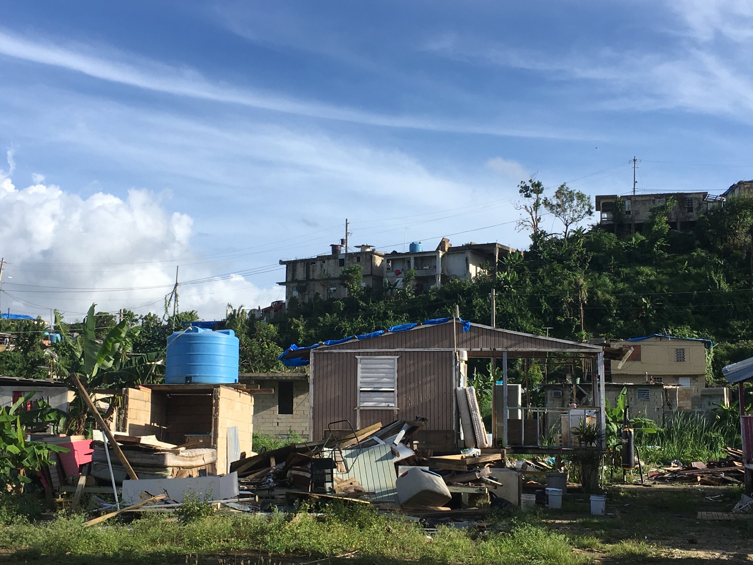
On April 26th, a group of experts from the fields of architecture, planning, engineering, construction, emergency management, energy and wastewater management gathered in Puerto Rico in part to kick-off the initiative to develop a resilient housing manual, but most importantly to receive critical feedback, engage in conversations and discuss the right direction to design and build safe and resilient housing and communities. 

Enterprise Community Partners and University of Puerto Rico School of Architecture and Planning assembled a comprehensive team of collaborators and experts, including the Urban Risk Lab, to develop a decision-making tool to assist housing designers, operators, construction professionals, owners and regulators to determine resilience strategies to make homes safer from extreme weather.

Publication in English and Spanish is planned for 2019.

For more information regarding the April 26th event, click on the following news outlet links: El Nuevo Día, Notiuno, WIPR – Noticias 24/7

"A Better Nation by Design" SUTD Ministerial Forum 2018

April, 2018


Miho Mazereeuw, Delane Foo Wei En and Kenneth Teo Liguang presenting token to Prime Minister Lee Hsien Loong

Miho Mazereeuw, Delane Foo Wei En and Kenneth Teo Liguang presenting token to Prime Minister Lee Hsien Loong

Prime Minister Lee Hsien Loong came to Singapore University of Technology and Design (SUTD) to talk about the issues that affect Singapore and the role of design in addressing them.

In collaboration with SUTD International Design Center (IDC) and Will&Well, the Urban Risk Lab designed a shirt and pin to present to the Prime Minister. These objects are made with photochromic materials that change colors when exposed to UV as a way to alert people when UV reaches dangerous levels and to promote awareness of the increasing high UV and heat risks in Singapore.

This is part of an ongoing research and design series of products to embed design preparedness and awareness into everyday objects.

For more information about the SUTD Ministerial Forum, visit the SUTD page

Petabencana.id received 2017 ISIF Asia - Internet for Development Award

December, 2017


171221_ISISasia.jpg

Petabencana.id - Indonesian deployment of the Urban Risk Map project received 2017 ISIF Asia - Internet for Development Award. The Information Society Innovation Fund (ISIF Asia) is a grants and awards program empowering communities in the Asia pacific region to research, design and implement Internet-based solutions for their own needs, placing particular emphasis on the positive role the Internet has in social and economic development in the region.


Urban Risk Lab participates in the Conference on the Resilient Reconstruction of the Caribbean organized by MIT energy initiative

December, 2017


171213_ResilientCarriebeanConf.jpeg

This conference framed and mobilized a multidisciplinary research and outreach program based both at MIT and in the region. It was centered around three key issues - The Electrification; the “Infrastructure: Blue-green and Gray” impacted by modified landscapes and physical infrastructure; and “Human Settlements.” Prof. Miho Mazereeuw, along with Prof. Larry Vale organized the human settlements vertical that brought together practitioners from the Caribbean and MIT for a constructive dialogue towards next steps for a resilient future of the Caribbean.


Miho Mazereeuw a featured speaker at Dangerous Landscapes Conference in Hannover Germany

November, 2017


171120_herrenhausen-560x300.png

Dangerous Landscapes - Rethinking Environmental Risk in Low-Income Communities was part of the Herrenhausen Conference Series initiated by Volkswagen Foundation. It explored the development of integrated risk reduction strategies in regions and cities vulnerable to climate change and rapid urbanization, and specifically examined trans-disciplinary, community based, and emerging approaches to disaster risk reduction in low-income communities.

The title of Miho's talk was Resilient Futures: Working to Reduce Risk through Design and Technology. 


Urban Risk Lab's Prephub Nepal project wins LafargeHolcim Award

November, 2017


171124_Holcim_awards2.jpg

This project replaces an existing dilapidated guesthouse with a new multifunctional building. The new structure restores and enhances a historic Paati – a type of covered public space – that was damaged in the 2015 earthquake. Wrapped around the Paati with its carefully restored 100-year old carved wooden columns and insets is a plinth design with a water tank at the center. The tank is used to collect and store water to enhance disaster preparedness. 

This project is supported by TATA Center of Technology and Design and is being implemented in partnership with Kathmandu based not-for-profit organization, Lumnati Support Group for Shelter

For more information visit Lafarge Holcim Foundation project page: Winners of the LafargeHolcim Awards 2017 for Asia Pacific

PREPHub project selected to participate in MIT Design X 2018 Accelerator Cohort

November, 2017


180220_designnx.png

DesignX is an inter-disciplinary program that combines academic discourse, data-informed design and an embrace of entrepreneurship to develop and launch new technologies and businesses directed toward innovation in design, cities and the built environment. 

The Venture Accelerator Program is an opportunity to explore ways to scale PREPHub research into a sustainable venture in multiple cities around the world. 


Riskmap.in launched in Chennai to help citizen-led efforts for Monsoon flooding

November, 2017


170211_Riskmapdeployment.png

Urban Risk Lab launched Riskmap.in - Crowdsourced flood reporting platform in the city of Chennai, India. During the first week of November, Chennai has received very heavy rainfall resulting in a disruption in daily life as well as water-logging in many parts. This project will help residents report instances of water logging, flooding, blocked or open drains and fallen trees on a public map in real-time. 

This project is supported by TATA Center of Technology and Design and is deployed in partnership with Chennai based not-for-profit organization, Citizen Consumer and Civic Action Group (CAG).

link to the News article.

PREPHub a Finalist in the 2017 Fast Company Innovation by Design Awards - Fastcodesign.com

September, 2017


170919_PREPHub_Fastco.jpg

The PREPHub project has been named a finalist in the 2017 Fast Company Innovation by Design Awards competition in the Spaces, Places, and Cities category, alongside projects from Thomas Heatherwick, BIG, and SO-IL. Thank you to all of our amazing partners, past and present, who support this work and continue to push it forward.

Riskmap.us launches for Broward County, FL in advance of Hurricane Irma

September, 2017


170919_RiskmapUS.png

With Hurricane Irma bearing down on South Florida, the Urban Risk Lab launched a pilot of a crowd sourced map that gathers real time reports of flooding for use by the public and emergency first responders. Similar to Petabencana.id in Indonesia, Riskmap.us harnesses the power of social media to gather, sort, and display information about flooding in real time. Currently operating in Broward County, we hope to expand the platform to more US locations in the near future. 

MIT News Article


OECD features Petabencana.id - Indonesian deployment of the Urban Risk Map - in its Embracing Innovation in Government: Global Trends 2017 report

March, 2017


170116_Tech Review.png

Embracing Innovation in Government is authored by the OECD Observatory of Public Sector Innovation (OPSI), and is informed by a global review of ways governments are transforming their operations and improving the lives of their citizens though innovation. Urban Risk Lab has developed Petabencana.id - realtime crowdsourced flood map in collaboration with USAID, Pacific Disaster Center and is being operated in partnership with BNPB - national disaster management agency of the country.